
Virtually every aspect of human activity from agriculture to zoning is impacted and shaped by geography. But while conventional maps depict borders, physical features and place names in precise detail, they shed little light on the way people interact in a geographic context—with the world, their environment, and each other.
Now, Geographic Information Science (GIS), a fast-growing field that marries human geography with social science, promises to revolutionize geography, with profound and far-reaching benefits.
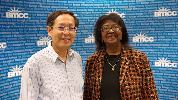
This year, professors Emily Anderson, chairperson of BMCC’s Department of Social Sciences and Human Services Department, and Chin-Song Don Wei, of the Department of Computer Systems, received a $300,000 grant from the National Science Foundation in support of Fostering Student Success in Geospatial Technology, a project focused on developing and implementing five courses within a GIS program at the college.
Building skills to address critical challenges
The courses, offered jointly by the two departments, “will help students build their knowledge of GIS and gain the critical thinking and analytical competencies needed to address some of today’s most compelling social issues,” says Wei.
In addition, workshops and other resources will help faculty become conversant in GIS and its related software.
“GIS is an incredibly powerful and flexible tool for mapping and analyzing spatial relationships and their impact on people and how they live their lives,” Anderson says. “I can’t think of an area where it isn’t relevant—the private sector, healthcare, forensic science, environmental protection, construction, disaster relief.”
Indeed, GIS is already used widely by businesses, governments, and scientific research organizations. And, with the state of the art advancing rapidly, even more exciting possibilities are on the horizon. A case in point: storm-tracking and disaster preparation.
“With GIS, the technology is getting better and better every day,” Wei says. “Meteorologists can not only locate a storm, they can literally see it, and visually track its path and trajectory with incredible accuracy.”
While GIS enables faster and more effective responses to superstorms and other major weather events, Anderson adds, “it can also help us plan far ahead into the future around issues related to sustainability and climate change.”
With courses in the basic information sciences (computer programming, database, remote sensing, and GIS), mathematics (pre-calculus and statistics) and geography (human geography, population geography and environmental conservation), BMCC’s GIS curriculum will offer internship opportunities and prepare graduates for entry level positions in the field.
The curriculum also facilitates seamless transfer to senior colleges, such as Hunter College, with 60 credits towards a BA in Geography with a concentration in GIS.
Fitting the curriculum to the setting
To be sure, BMCC is not the only community college to offer a degree in GIS, but it may be the first with a curriculum that focuses on GIS applications to urban development.
“A degree program in Kentucky, where the emphasis might be on forestry, or Arizona, where deserts are the dominant feature, would differ from a program in a major urban location, where the planning needs are totally different,” says Wei. “The idea is to fit the curriculum to local needs. “
In a real sense, GIS lies at the intersection of science and the study of human behavior.
“It’s a field that marries scientific skill-sets with insights into how people interact with other and the world around them—and the consequences of those interactions,” says Wei.
Adds Anderson, “One of the things I find most exciting about GIS is its interdisciplinary nature. Instead of placing the sciences in one bucket, and the arts and humanities in another, GIS combines them in a way that can truly improve our lives.”
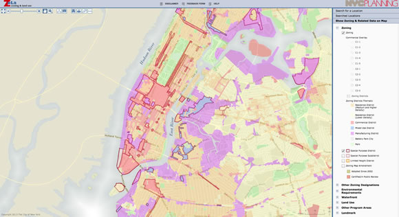
Examples of a Map and multiple layers in GIS application:
City Planning Commissioner Amanda M. Burden and Department of Information Technology & Telecommunications (DoITT) Commissioner Carole Post announced launch of ZoLa, the Zoning and Land Use web application, which provides a new and simple way to find a wide range of land use information in interactive, highly-readable map layers pertaining to a particular property, or to the city at large.
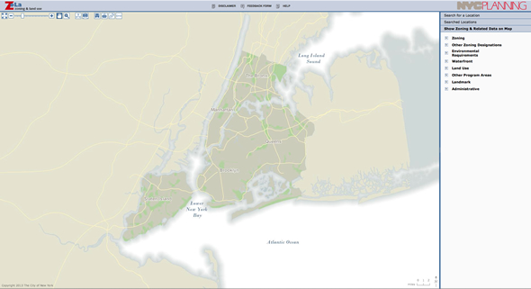
In Zola, a web map which is a base map displays an area of Manhattan.
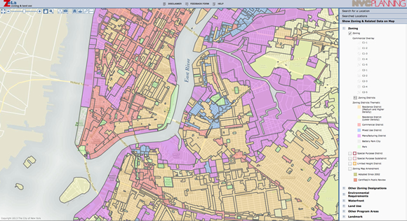
A zoning layer was added by clicking the Zoning check box on the right panel.
The second layer of Special Purpose District was added on the top of Zoning layer.

The third layer of Special Purpose Subdistrict was added on the top of Zoning layer and Special Purpose District layers.
STORY HIGHLIGHTS
- With a $300,00 NSF grant, two BMCC professors develop a curriculum around Geographic Information Systems
- Initiative joins Computer Sciences and Social Sciences in a unique interdisciplinary collaboration
- Breakthrough technology offers the potential for immediate and long-term improvements in people’s lives
